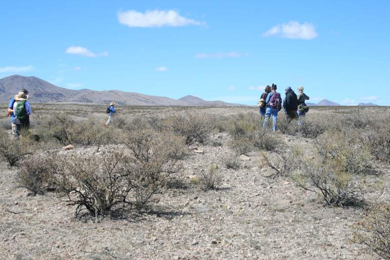
The March 3, 2019, GCAS field trip to Indian Wells was enlightening on several levels. Chris Overlock’s photos gave a good overview of the general terrain and vegetation, and showcased the classic GCAS looking-for-potsherds stoop that we all know and love. Here in Part II, is a second view of the overall terrain of Indian Wells, followed by a brief illustration of what a bulldozed archaeological site looks like for those who may not have ever seen one before.
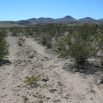
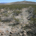
These two photos were taken at the Indian Wells pueblo site. The first photo looks out along a set of bulldozer tracks; the low mound in the upper left where the tracks end is the pile of rubble the bulldozer left behind. The second photo shows another set of bulldozer tracks, with piles of rubble to the left and to the right of where the tracks stop, and in the distance toward the right where a mound of bare ground is visible. Of course, in this case “rubble” and the rocks seen in the foreground are all that remain of what was once the pueblo’s walls and foundations.
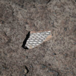
This last photo is of one of only 6 small sherds of black-on-white pottery any of the 11 of us found at any of the 3 sites at Indian Wells. That’s how picked-clean the surface is, to this day. So if any of you out there in cyberspace ever visit Indian Wells or any other archaeological site, if you could just be cool and leave sherds where they are, that would be really great.